|
|
|
|
|
|
|
|
|
|
|
|
| Along a stretch of asphalt that includes what's popularly dubbed The Loneliest Road In America, US Highway 50 passes through some 230 spectacular miles of fossil-rich Great Basin territory. Included here are on-site photographs and images of representative paleontologic specimens from every fossil-bearing geologic rock formation I have personally investigated in the neighborhood of the route, from the vicinity of Eureka, Nevada, to Delta in Millard County, Utah. |
 |
 |
|
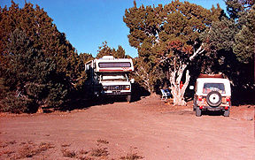
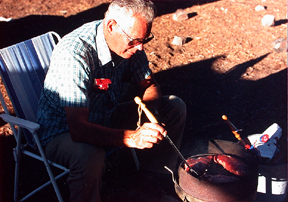
Click on the images for larger pictures. Left--The old camping site at Little Antelope Summit (elevation 7,438 feet), White Pine County, Nevada, that travelers along the Loneliest Road in American (US Highway 50) used to utilize as a de facto base camp/rest stop. Right--A visitor to the old camping site at Little Antelope Summit (elevation 7,438 feet), White Pine County, Nevada, along the Loneliest Road in American (US Highway 50), cooks up some tasty meats for dinner. |
 |
 |
|
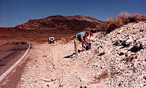
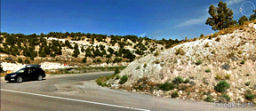
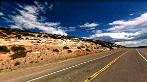
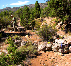
Click on the images for larger pictures. Left--Two Great Basin explorers examine an exposure of fossiliferous limestone in the vicinity of Little Antelope Summit, White Pine County, Nevada, that produces beaucoup fresh water coiled gastropods from a middle Eocene geologic rock unit that is correlated statigraphically with an Eocene sedimentary section of the upper Cretaceous to middle Eocene Sheep Pass Formation, White Pine County, Nevada. The Sheep Pass deposit yields abundant fresh water gastropods, pelecypods (AKA, the bivalves), and ostrocods (a minute bivalved crustacean--sometimes colloquially called a seed shrimp)--in addition to roughly 40 species of vertebrate remains: amphibians (spectacular complete frog skeletons, in particular), reptiles, birds, and early extinct mammals--the first confirmed Eocene vertebrate fossil-bearing geologic rock unit recognized from the Great Basin district. Right--A Google Earth street car perspective that I edited and processed through photoshop. Every rock within view belongs to the upper Cretaceous to middle Eocene Sheep Pass Formation, White Pine County, Nevada. The Sheep Pass geologic interval produces significant paleontological specimens--complete frog skeletons, reptiles, birds, mammals, gastropods, pelecypods, and ostracods. |
 |
 |
|
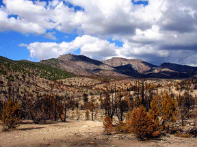
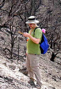
Click on the images for larger pictures. Left--Exposures of the richly fossiliferous upper Cretaceous to middle Eocene Sheep Pass Formation, White Pine County, Nevada, occur in the hills in middleground of photograph. The Sheep Pass deposit yields locally abundant fresh water gastropods, pelecypods (AKA, the bivalves), and ostrocods (a minute bivalved crustacean--sometimes colloquially called a seed shrimp)--in addition to roughly 40 species of vertebrate remains: amphibians (spectacular complete frog skeletons, in particular), reptiles, birds, and early extinct mammals--the first confirmed Eocene vertebrate fossil-bearing geologic rock unit recognized from the Great Basin district. Right--Geologist/paleontologist Dr. Peter A. Druschke (who's discovered several fantastic fossil frog specimens in Nevada) examines the amphibian-bearing upper Cretaceous to middle Eocene Sheep Pass Formation in White Pine County, Nevada. Photographs courtesy Amy Henrici--collection manager for the Section of Vertebrate Paleontology at Carnegie Museum of Natural History Museum; I edited and processed the images through photoshop. |
 |
 |
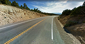
| Click on the images for larger pictures. Left--The roadcut exposes a dominantly fluviatile (river or stream-deposited) sandstone facies of the lower Cretaceous Newark Canyon Formation in eastern Eureka County, a number of miles from the western border of White Pine County, Nevada; a Google Maps street car perspective that I edited and processed through photoshop. Right--A paleontologist explores fossiliferous outcrops of the lower Cretaceous Newark Canyon Formation in Eureka County, Nevada, a number of miles from the western border of White Pine County, Nevada. The freshwater Newark Canyon Formation yields an excellent fossil record of early Cretaceous times: an extinct ray-finned fish; gar fish; a freshwater shark; the turtle genus Glyptops; crocodilians, a small herbivorous dinosaur in the family Euornithopoda; a large plant-eating dinosaur in the family Iguanodontidae; an armored dinosaur from the family Ankylosauridae; skeletal elements from sauropod and theropod dinosaurs; eggshell fragments from the oogenus Elongatoolithus (oviraptors); a dromaeosaur dinosaur; extinct multituberculate mammals; gastropods; peleycypods; ostracods; petrified woods; leaves; charophytes (freshwater green algae); and pollens. Photograph courtesy Dr. Joshua William Bonde, Dr. Richard P. Hilton, Dr. Frankie D. Jackson, and Dr. Peter A. Druschke; I edited and processed the image through photoshop. |
 |
 |
|
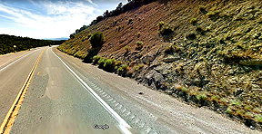
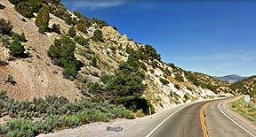
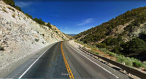
Click on the images for larger pictures. Left--A Google Maps street car perspective that I edited and processed through photoshop. Here's a roadcut in White Pine County, Nevada, that exposes the lower member of the middle Permian Arcturus Formation--primarily a medium gray limestone with subordinate interbeds of siltstone and sandstone; total thickness is roughly 1,200 to 1,500 feet thick. Right--A Google Maps street car perspective that I edited and processed through photoshop. A roadcut in White Pine County, Nevada, that exposes the exact geologic contact between the lower and upper members of the middle Permian Arcturus Formation. The grayish rocks represent the lower limestone member, while that reddish-brown slope lies within the upper Arcturus member, which consists of sandstone and siltstones interlayered with platy limestone; thickness of the upper member is approximately 1,500 to 1,600 feet. The middle Permian Arcturus Formation is locally quite fossiliferous, bearing a distinctive invertebrate fauna of gastropods, pelecypods (the bivalves), brachiopods, corals, foraminifers, bryozoans, and echinoderm spines (which frequently weather free from the sedimentary matrix by the zillions). |
 |
 |
|
Click on the images for larger pictures. Left--A Google Maps street car perspective that I edited and processed through photoshop. A roadcut in White Pine County, Nevada, that exposes the precise geologic contact between the lower Permian Riepe Spring Limestone and the lower to middle Permian Reipetown Formation (formerly called the Rib Hill Sandstone). That prominent grayish ridge along the slope at roughly upper center-left lies in the Riepe Spring Limestone; the subdued rubble-strewn slope to left edge of photograph is the overlying and geologically younger Riepetown Formation (which directly underlies the middle Permian Arcturus Formation). The Riepetown is dominantly around 1,100 to 1,200 feet of yellow-gray siltstone and sandstone, with occasional interlayered beds of yellowish-gray dolomite and limestone. A coarse-grained medium-gray bioclastic limestone occurs at the base, near the contact with the underlying Riepe Spring Limestone. The Reipetown yields locally abundant conodonts (minute tooth-like structures, unrelated to modern jaws, that helped process food in an extinct lamprey eel-like organism) fusulinids, bryozoans, pelecypods, and various invertebrate tracks. Right--A Google Maps street car perspective that I edited and processed through photoshop. A road in White Pine County, Nevada, passes through the lower Permian Riepe Spring Limestone. Every rock in view, to the bend in highway up ahead, belongs to the fossiliferous Riepe Sping Limestone, which consists of 275 to 350 feet of generally fine to moderately crystalline medium to dark gray bioclastic limestone. Prominent limestone ledges often produce prodigious numbers of coral specimens; fusulinid coquinas common. Brachiopods, bryozoans, conodonts, and crinoid stems are locally abundant, as well. |
 |
 |
 |
 |
|
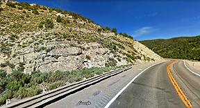
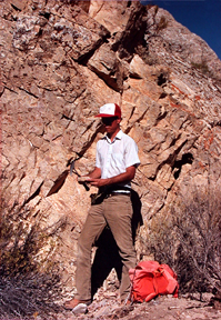
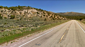
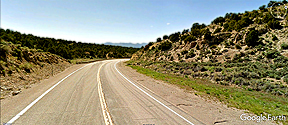
Click on the images for larger pictures. Four views of the lower to middle Pennsylvanian Ely Limestone, White Pine County, Nevada. Top left and bottom left are Google Maps street car perspective images; bottom right is a Google Earth street car photograph; and top right shows an eager seeker of Pennsylvanian paleontology investigating an outcrop of the lower to middle Pennsylvanian Ely Limestone. I edited and processed all the Google photographs through photoshop. The Ely Limestone consists of approximately 2,450 to 2,600 feet of light olive-gray to brownish-gray thin to thick-bedded chert-rich limestone, with occasional sandstone and siltstone horizons in its upper portions. It bears a prolific invertebrate fossil fauna--producing: algae (encrusting and phylloid varieties, Tubiphytes, Komia, Osagia, stromatolites); foraminiferera (fusulinids, endothyrids); sponges (AKA, the Porifiera: Chaetetes and spicules); brachiopods (all three primary shell types--punctate, impunctate, pseudo-punctate--plus, spines); corals (extinct tabulate and rugose forms--some coral heads up to five feet across); bryozoans (twig-like, encrusting, and fenstrate); mollusks (gastropods, pelecypods, ammonoids, and several miscellaneous kinds); arthropods (trilobites and ostroacods); echinoderms (crinoids and echinoid spines); and conodonts (diminutive tooth-like denticles, unrelated to modern jaws, that served to enable food gathering in an extinct lamprey eel-like organism). |
 |
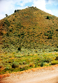 |
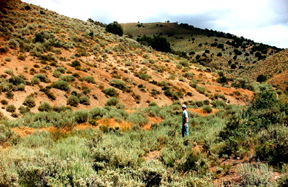
| Click on the images for larger pictures. Left--A visitor of the Paleozoic Era stands next to a hill composed of the upper Mississippian Diamond Peak Formation, eastern Eureka County, Nevada, not far from the western border of White Pine County, Nevada. Right--A hill composed of upper Mississippian Diamond Peak Formation in eastern Eureka County, Nevada, not far from the western border of White Pine County, Nevada. The Diamond Peak Formation produces one of the largest late Mississippian fossil faunas in the US West, including: foraminfera; corals; bryozoans; brachiopods; gastropods; pelecypods (AKA, the bivalves); cephalopods (numerous species of goniatites ammonoids); crinoids; ostracods; and conodonts (diminutive tooth-like denticles, unrelated to modern jaws, that served to enable food gathering in an extinct lamprey eel-like organism). |
 |
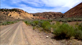 |
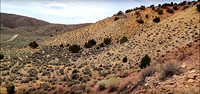
| Click on the images for larger pictures. Left--Fossil-bearing exposures of the upper Mississippian Diamond Peak Formation along the slopes at right in Elko County, Nevada, north of White Pine County, Nevada. Right--Richly fossiliferous exposures of the upper Mississippian Diamond Peak Formation at upper left in Elko County, Nevada, north of White Pine County, Nevada. The Diamond Peak Formation produces one of the largest late Mississippian fossil faunas in the US West, including: foraminfera; corals; bryozoans; brachiopods; gastropods; pelecypods (AKA, the bivalves); cephalopods (numerous species of goniatites ammonoids); crinoids; ostracods; and conodonts (diminutive tooth-like denticles, unrelated to modern jaws, that served to enable food gathering in an extinct lamprey eel-like organism). Photographs courtesy an individual who goes by the cyber-name KOI. I edited and processed the images through photoshop. |
 |
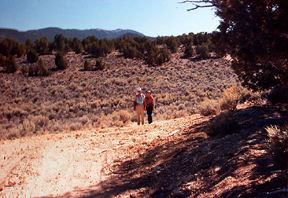 |
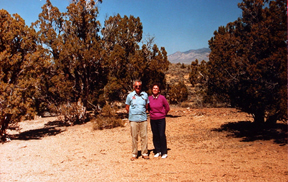
| Click on the images for larger pictures. Left--The author's parents stand atop highly eroded upper Mississippian Diamond Peak Formation in White Pine County, Nevada, north of Antelope Summit. This is the exact spot where years earlier my father had camped while completing his Summer Field Course (mapping in full geological detail a portion of a geographic quadrangle) for a Bachelor of Science degree in geology from the University of Southern California; he also went on to gain a Master of Science degree in engineering geology from the University of Southern California. Right--The author's parents return from a hike north of Little Antelope Summit, White Pine County, Nevada, in search of fossil cephalopods and gastropods in the upper Mississippian Diamond Peak Formation. The Diamond Peak Formation produces one of the largest late Mississippian fossil faunas in the US West, including: foraminfera; corals; bryozoans; brachiopods; gastropods; pelecypods (AKA, the bivalves); cephalopods (numerous species of goniatites ammonoids); crinoids; ostracods; and conodonts (diminutive tooth-like denticles, unrelated to modern jaws, that served to enable food gathering in an extinct lamprey eel-like organism). |
 |
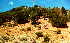 |
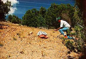
| Click on the images for larger pictures. Left and right--Seekers of Paleozoic Era paleontology examine outcrops of the middle to upper Mississippian Chainman Shale in White Pine County, Nevada. The Chainman Shale yields locally prodigious quantities of goniatites ammonoids, gastropods, and brachiopods in White Pine County, Nevada, and Millard County, Utah. |
 |
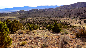 |
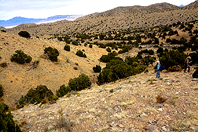
| Click on the images for larger pictures. Left and right--Two views of the middle to upper Mississippian Chainman Shale in western Millard County, Utah, not far from the eastern border of White Pine County, Nevada. In image at right, the lower Mississippian Joana Limestone (yields lots of corals, brachiopods and crinoids) is seen in middle distance, just below the mountains on the skyline, directly above the ridge of Chainman Shale in middle ground. The Chainman Shale yields locally prodigious quantities of goniatites ammonoids, gastropods, and brachiopods in White Pine County, Nevada, and Millard County, Utah. Photographs courtesy S. Robert Bereskin, John D. McLennan, Thomas C. Chidsey Jr., and Peter J. Nielsen; I edited and processed the images through photoshop. |
 |
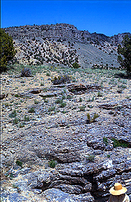 |
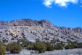
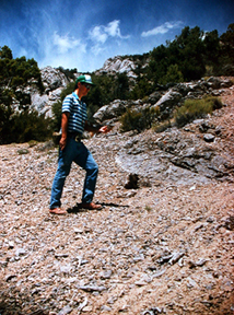
| Click on the images for larger pictures. Left--In western Millard County, Utah, near the eastern boundary with White Pine County, Nevada, the middle Mississippian Joana Limestone forms a massive ledge along the ridgeline, with the more recessive late Devonian to lower Mississippian Pilot Shale eroding along the slopes. Photograph courtesy Harry E Cook and James J. Corboy; I edited and processed the image through photoshop. Right--In western Millard County, Utah, near the eastern boundary with White Pine County, Nevada, a classic geologic section exposes three Paleozoic Era rock formations: Ledge and level area at bottom to upper middle, above person with hat, is the middle to late Devonian Guilmette Formation--a noted producer of corals, stromatoporoids (extinct calcareous sponge), gastropods, brachiopods, crinoids, ostracods, and conodonts; lighter-colored pale brown rocks, above the Guilmette, belong to the late Devonian to lower Mississippian Pilot Shale (contains many species of conodonts); and the massive darker colored strata, to the skyline, correspond to the middle Mississippian Joana Limestone (yields locally abundant corals, brachiopods and crinoids, in particular). Photograph courtesy Harry E. Cook and James M. Corboy; I edited and processed the image through photoshop. |
 |
 |
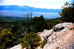
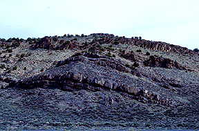
| Click on the images for larger pictures. Left--Rocks at right to center belong to the extratraordinarily fossiliferous middle to late Devonian Guilmette Formation, White Pine County, Nevada. Right--An explorer of the Paleozoic Era examines the wildly fossiliferous middle to late Devonian Guilmette Formation in White Pine County, Nevada. Every rock within view--to the skyline in distance--belongs to the Guilmette Formation, which here yields prodigious quantities of Paleozoic Era invertebrate animal remains: corals, stromatoporoids (extinct calcareous sponge), gastropods, brachiopods, crinoids, ostracods, and conodonts. |
 |
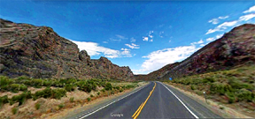 |
| Click on the images for larger pictures. Left and right--Exposures of the middle to upper Devonian Devils Gate Limestone in Eureka County, Nevada, a number of miles west of the western border of White Pine County, Nevada. Photograph at left courtesy Harry E. Cook and James J. Corboy; I edited and processed the image through photoshop. Photograph at right is a Google Maps street car perspectives that I edited and processed through photoshop. The Devils Gate produces numerous varieties of invertebrate animal remains--Brachiopods, crinoids, corals, bryozoans, ostracods, conodonts, stromatoporoids (an extinct calcareous sponge), and gastropods. |
 |
 |
|
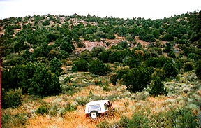
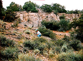
Click on the images for larger pictures. Left--The CJ7 jeep is facing excellent fossiliferous exposures of the lower to middle Devonian Nevada Formation in White Pine County, Nevada. Right--An enthusiastic Devonian Period adventurer explores fossil-bearing outcrops of the lower to middle Devonian Nevada Formation in White Pine County, Nevada, which here yields abundant beautiful brachiopods that weather out of the calcareous sediments whole and intact. Elsewhere, the Nevada Formation produces numerous kinds of corals, as well. Note--The Nevada Formation of long-held, time-honored usage represented five regionally mappable subunits, or members, which in ascending order or geologic age consisted of: Beacon Peak Dolomite; Oxyoke Canyon Sandstone; Sentinel Mountain Dolomite; Woodpecker Limestone; and Bay State Dolomite. Current stratigraphic convention abandons the term Nevada Formation altogether in favor of elevating to full formational rank all five individual members. Herein, though, I summarily reject that stratigraphic reorganization and continue to use the older, more appropriate designation--Nevada Formation, retaining as distinct subunits the five recognizeable members. |
 |
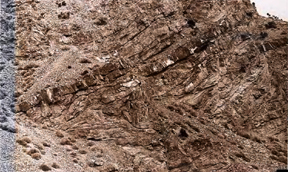 |
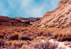
| Click on the images for larger pictures. Left--Exposures of the lower Devonian Rabbit Hill Limestone along the slopes at right; Eureka County, Nevada, a number of miles from the western border of White Pine County, Nevada. Fossiliferous Middle Ordovician Antelope Valley Limestone, geologically thrust over the younger Rabbit Hill Limestone in dramtic fashion, forms the hills on skyline in middle distance. Bottom--A close view of folds and general geologic deformation in the lower Devonian Rabbit Hill Limestone in Eureka County, a number of miles from the western border of White Pine County, Nevada. Photograph courtesy Terry A. Grant; I edited and processed the image through photoshop. The Rabbit Hill is a prodigious producer of early Devonian Period invertebrate animal life, including--brachiopods, corals, crinoids, gastropods, trilobites, bryozoans, and conulariids (a poorly understood type that might be related to scyphozoan cnidarians). |
 |
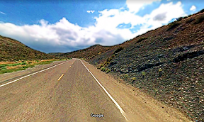 |
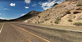
| Click on the images for larger pictures. Left--A roadcut exposes the upper Silurian Lone Mountain Dolomite in eastern Eureka County, Nevada, not far from the western border of White Pine County, Nevada. The Lone Mountain geologic unit yields locally common corals, crinoid stems, and brachiopods. A Google Maps street car perspective that I edited and processed through photoshop. Right--A roadcut exposure (at right) of the upper Ordovician to lower Silurian Hanson Creek Formation in Eureka County, Nevada, a number of miles west of the western border of White Pine County, Nevada. Produces locally common brachiopods, crinoid columnals, graptolites, and corals, in addition to important suites of latest Ordovician conodonts (minute tooth and jaw-like structures, unrelated to modern jaws, that served as a unique food-gathering apparatus in an extinct lamprey eel-like animal), just prior to the great extinction event at the conclusion of the Ordovician Period. A Google Maps street car perspective that I edited and processed through photoshop. |
 |
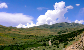 |
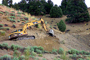
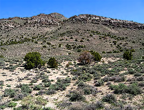
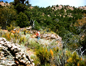
| Click on the images for larger pictures. Left--A dozer operator excavates for professional invertebrate paleontology studies (by university professors) rich graptolite-bearing shales in an upper Ordovician section of the middle to upper Ordovician Vinini Formation, Eureka County, Nevada, a number of miles west of the western border of White Pine County, Nevada. Photograph courtesy S. C. Finney; I edited and processed the image through photoshop. Right--Hills to right of dirt trail are underlain by the graptolite-bearing shales and siltstones of the middle to upper Ordovician Vinini Formation, Eureka County, Nevada, a number of miles west of the western border of White Pine County, Nevada. Photograph courtesy Charles E. Mitchell; I edited and processed the image through photoshop. The Vinini Formation produces world-class suites of middle to latest Ordovician graptolites, plus numerous conodont species and even the relatively rarely encoutered (in the geologic record) Caryocaris--an extinct bivalved crustacean. |
 |
 |
| Click on the images for larger pictures. Left--Outcrops of the late middle Ordovovician Antelope Valley Limestone in Eureka County, Nevada (hills in middle distance), a number of miles west of the western border with White Pine County, Nevada; capping the hills is the upper Ordovician Eureka Quartzite. The Antelope Valley geologic rock unit yields a wide assortment of paleontologic material, including: trilobites, brachiopods, ostracods, bryozoans, conodonts, gastropods, sponges, Receptaculites (an extinct green algae), and early echinoderms. Photograph courtesy Rachel Dolbier, Daniel M. Sturmer, Thomas Anderson, and Regina N. Tempel; I edited and processed the image through photoshop. Right--A paleontology adventurer examines fossiliferous limestones in the late middle Ordovician Lehman Formation of the lower to middle Ordovician Pogonip Group, White Pine County, Nevada. Rocks along skyline also belong to the Lehman Formation, the youngest member of the Pogonip Group, which here produces prodigious quantities of large Leperdetia ostracods (a bivalve crustacean that is usually quite diminutive, ranging in average long dimension no greater than a millimeter, 3/64 of an inch)--in addition to locally common brachiopods and gastropods. |
 |
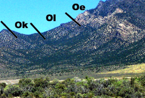 |
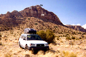
| Click on the images for larger pictures. Left--A geologically instructive outcrop in western Millard County, Utah, a number of miles east of the eastern border of White Pine County, Nevada, that reveals the fossil-bearing late middle Ordovician Kanosh Shale and Lehman Formation overlain by late Ordovician sedimentary rock units. Symbols on the image designate the following (I added the lettering to the original photograph, by the way): Ok--late middle Ordovican Kanosh Shale (extraordinarily fossiliferous--second-youngest member of the Pogonip Group_); Ol--late Ordovician Lehman Formation (notably fossiliferous--youngest member of the Pogonip Group); Ow--Watson Ranch Quartzite (unfossiliferous); Cp--late Ordovician Crystal Peak Dolomite (here, unfossiliferous); Oe--upper Ordovician Eureka Quartzite (here, unfossiliferous). Photograph courtesy James R. Bain; I edited and processed the image through photoshop. Right--A view to a mountain slope in White Pine County, Nevada, that reveals excellent exposures of the profusely fossiliferous late middle Ordovican Kanosh Shale and Lehman Formation, overlain by the unfossiliferous late Ordovician Eureka Quartzite. Lettering on photo denotes the following: Ok--late middle Ordovician Kanosh Shale; Ol--late middle Ordovician Lehman Formation; Oe--Eureka Quartzite. That darkish material above the Eureka Quartzite, to upper right edge of photograph, is the upper Ordovician through lower Silurian Ely Springs Dolomite; sliver of strata to the immdediate left of the Kanosh Shale, to left edge of image, is the middle Ordovician Shingle Pass Limestone. Photograph courtesy Cole T. Edwards and Matthew R. Saltzman. The Kanosh and Lehman geologic units produce prolific suites of early Paleozoic Era invertebrate remains, including: brachiopods, echinoderms, bryozoans, ostracods, sponges, graptolites, gastropods, pelecypods, cephalopods, conodonts, trilobites, and Receptaculites green algae. |
 |
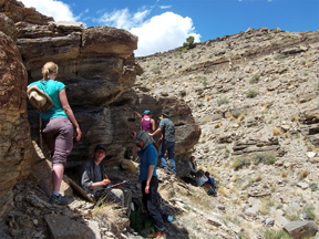 |
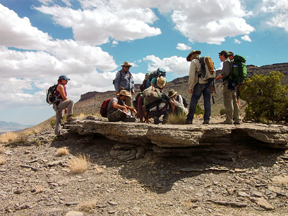
| Click on the images for larger pictures. Left--Paleontology field trip participants stand atop a characteristic ledge of limestone in the lower Ordovician Juab Limestone (third-youngest member of the Pogonip Group) in western Millard County, Utah, a number of miles east of the eastern border of White Pine County, Nevada. Many invertebrate types are well represented in the Juab, with brachiopods, gastropods, cephalopods, trilobites, conodonts, solitary sponges, and graptolites especially characteristic of the predominantly calcium carbonate geologic accumulation. Right--Folks attending a field trip to the Great Basin district find welcomed shade from an exposure of the lower Ordovician Wah Wah Limestone (third-oldest member of the Pogonip Group) in western Millard County, Utah, a number of miles east of the eastern border of White Pine County, Nevada. Silicified trilobites, algae-sponge patch reefs, conodonts (a minute feeding apparatus, unrelated to modern jaws, from an extinct eel-like organism--seen only in the insoluble residues of carbonates dissolved in a dilute solution of acetic or formic acid), graptolites, gastropods, brachiopods, solitary sponges, nautiloid cephalopods, and cystoid echinoderms constitute members of a large and diverse fossil assemblage from the Wah Wah. Photographs courtesy Dave Smith; I edited and processed the images through photoshop. |
 |
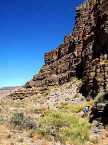 |
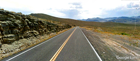
| Click on the images for larger pictures. Left--A roadcut that exposes the lower Ordovician Fillmore Formation in Millard County, Utah, a number of miles east of the eastern border of White Pine County, Nevada. The Fillmore Formation is the second-oldest geologic rock unit of the Pogonip Group, yielding such invertebrate animal groups as graptolites, trilobites, brachiopods, conodonts, gastropods, echinoderms, cephalopods, and occasional lenticular algae-sponge patch reefs. A Google Earth street car perspective that I edited and processed through photoshop. Right--A Great Basin paleontology field trip participant (lower right) inspects the lower Ordovocian House Limestone (oldest member of the Pogonip Group) in western Millard County, a number of miles east of the eastern border of White Pine County, Nevada. The House yields conodonts (minute parts of a unique feeding apparatus, unrelated to modern jaws, from an extinct lamprey eel-like animal), in addition to ledges of silicified (replaced by the mineral silicon dioxide) trilobites and brachiopods. Photograph courtesy Dave Smith; I edited and processed the image through photoshop. |
 |
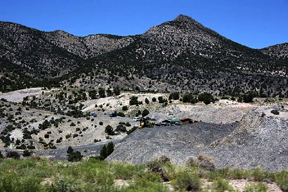 |
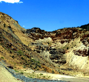
| Click on the images for larger pictures. Left--A photograph that shows the highly fossiliferous upper Cambrian Dunderberg Shale--brownish slopes at left--in gouged fault contact with the underlying upper Cambrian Hamburg Dolomite (mostly unfossiliferous, save for a few trilobites--the more ledge-forming material at center to right of image); the specific locality is an open pit gold reclamation mine in Eureka County, Nevada, a number of miles west of the western border of White Pine County, Nevada. The Dunderberg Shale produces a really huge fauna of trilobites. Photograph courtesy Richard Baker; I edited and processed the image through photoshop. Right--An overview of the middle Cambrian Wheeler Shale at Wheeler Amphitheater (AKA, Antelope Springs), western Millard County, Utah, a number of miles east of the eastern border of White Pine County, Nevada. All the graysish to tan-colored rocks in roughly middlegrould of photograph belongs to the Wheeler Shale, which yields a fantastic diversity of middle Cambrian fossil material: 35 species of trilobites; brachiopods; echinoderms, including an eocrinoid ("dawn crinoid") called Gogia; Phyllocarids (a bivalve crustacean with only two known living members)--including the extinct Brachiocaris and Pseudoarctolepsis; such early siliceous sponges as Diagonella, Choia, and Chancelloria; an early Chelicerate (horseshoe crabs, sea spiders, and arachnids are living members) called Esmeraldella; Naraoia, a so-called trilobitomorpha, or "soft-bodied trilobite;" Anomalocaris, the largest predator of the Cambrian seas; annelids (the worms), including famous Wiwaxia, which was first described from the astounding middle Cambrian Burgess Shale of Canada; and 20 species of non-mineralized arthropods unrelated to trilobites--in other words, soft-bodied animal remains rarely encountered in the fossil record. Photograph courtesy Paololitico F/Panoramio; I edited and processed the image through photoshop. |
 |
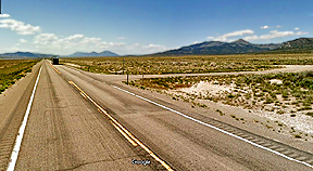 |
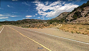
| Click on the images for larger pictures. Left--The dirt trail just right of center leads to a fossil brachiopod bonanza in the lower to middle Devonian Nevada Formation, White Pine County, Nevada. Right--One turns right on the dirt path up ahead to travel to an especially prolific fossil-yielding district in the middle to upper Devonian Guilmette Formation, White Pine County, Nevada. Both images are Google Earth street car perspectives that I edited and processed through photoshop. |
 |
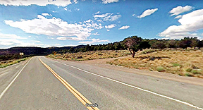 |
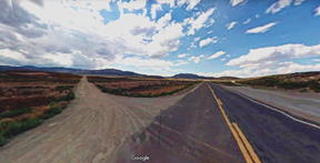
| Click on the images for larger pictures. Left--A view westward along Highway 50 (The Loneliest Road in America) in White Pine County, Nevada, to the turnoff to Hamilton Ghost Town--the dirt road at left. Right--The dirt path at right up ahead, in White Pine County, Nevada, leads northward through stupendous Great Basin isolation to the exact spot where my father camped while conducting his Summer Field Camp course (mapping in geological detail a specific portion of geographic quadrangle) to complete requirements for a Bachelor of Science degree from the University of Southern California. He also went on to gain a Master of Science degree in engineering geology from the University of Southern California. Both images are Google Earth street car perspectives that I edited and processed through photoshop. |
 |
 |
 |
 |
|
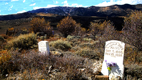
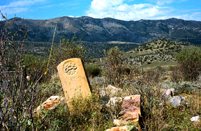
Click on the images for larger pictures. Top to bottom, left to right: Photographs courtesy--Bryan Chernic; Sydney Martinez; Sydney Martinez; Bryan Chernick. I edited and processed the images with photoshop. In late 1867 prospectors discovered rich silver ore bodies on Treasure Hill, but in quick time they proved to be shallow mineral reserves subject to rapid exploitation. By the end of 1868 some 10,000 adventurers had flocked to the district--most suffering through the typically severe winter conditions of eastern Nevada in hastily and poorly constructed mud huts, dugouts, houses of rough timber, and cotton tents. Water, timber, land, and mineral rights were all claimed, sold, and re-claimed many times over in a delirium of inflated speculation. Give the planners some credit, though. Before even a single child had appeared in Hamilton, citizens had already organized a school district complete with an elected board of trustees and a school site. By March, 1869, Hamilton became the county seat of White Pine County. Approximately 20,000 folks had rushed in. The downtown district featured 101 saloons, 59 general stores, dozens of lawyers, doctors, churches, fraternal orders, fire companies, banks, jewelers, theaters, miners' union, skating rinks, auction houses, breweries, a soda factory, gunsmiths, pawnbrokers, express facilities, and even a daily paper--the Daily Inland Impire. During the flush times, Hamilton had 195 incorporated mining companies, with stocks valued at over 70 million dollars. The peak years of mineral production were 1869 and 1970, when ore companies extracted $1,823,868 and $2,137,801 worth, respectively, from the mines. But the boom subsided quickly. A census conducted in 1870 showed that Hamilton's population had dropped to 6,800. A primary explanation for the sudden decrease was a local depression precipitated by uncertainty over the future of mining development. The shallow silver resources were vanishing, and speculators discovered that they could no longer realize up to $20,000 a crack for a "hole in the ground." By the hundreds miners packed up their beans and blankets and walked off. Hamilton's merchants also began to move out en mass. Still, Hamilton hung on for several additional years, even managing to survive the devastating fires of 1873 and 1885. Eventually, though, when Hamilton lost the county seat to Ely in 1887, the end was in sight. A minor resurgence of mineral interest in 1925 brought in a few hundred people, but the mini-boom went bust in a hurry and Hamilton returned to the ghosts. |
 |
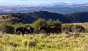 |
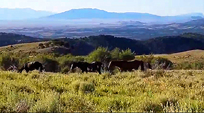
| Click on the images for larger pictures. Left and right--Wild horses in White Pine County, Nevada, not far from Hamilton ghost town. Photographs courtesy an individual who goes by the cyber-name Relic Ryan. I edited and processed the images with photoshop. |
 |
 |
|
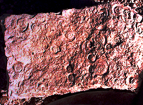
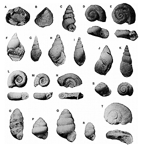
Click on the images for larger pictures. Left--Freshwater mollusks from the lower Eocene section of the upper Cretaceous to middle Eocene Sheep Pass Formation, White Pine County, Nevada. The specimens can be assigned to the genus Biomphalaria. Right--Freshwater mollusks from the latest Cretaceous to middle Eocene Sheep Pass Formation, White Pine County, Nevada. Top row, left to right: (A) Sphaerium; (B) Psidium; (C) Hydrobia; (D)Valvata subumbilicata; (E) Valvata bicinta. Second row, left to right: (F) Lymnaea similis; (G) Lymnaeidae; (H) Lymnaea; (I) Lymnaea; (J) Physa; (K) Physa longiuscula. Third row, left to right: (L) Biomphalaria sequalis; (M) Biomphalaria storchi; (N) Biomphalaria psuedoammonius; (S) Helix; Fourth row, left to right: (O) Pupilla; (P) Chaenaxis; (Q) Vertigo; (R) Vertigo arenula; (T) Glyterpes rotundata. Photograph courtesy a specific technical document. |
 |
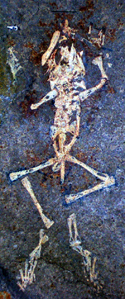 |
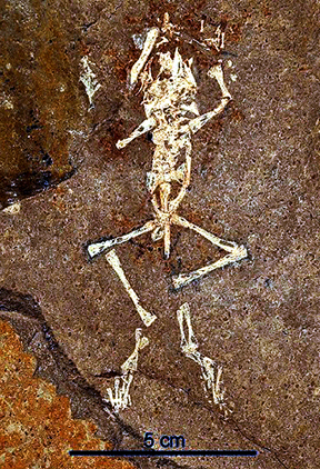
| Click on the images for larger pictures. Left and right: Two photographic perspectives of a fossil frog--Eorubeta nevadensis--from the latest Cretaceous to early Paleocene section of the upper Cretaceous to middle Eocene Sheep Pass Formation, White Pine County, Nevada. Note black five centimeter bar at bottom of image at left. Photographs courtesy Dr. Joshua William Bonde. I edited and processed the images with photoshop. |
 |
 |
|
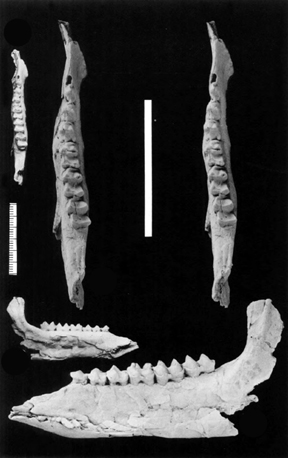
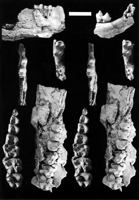
Click on the images for larger pictures. Left--Different viewing perspectives of the same left mandibular ramus (left lower jaw bone) from an extinct tapir, called scientically Fouchia elyensis. From the early middle Eocene section of the upper Cretaceous to middle Eocene Sheep Pass Formation, White Pine County, Nevada. Scale at left-center is in millimeters; longer scale is roughly upper center is 3 centimeters long. Photograph courtesy Dr. Robert J. Emry. I edited and processed the image with photoshop. Right--Tapir jaw material from the lower middle Eocene section of the upper Cretaceous to middle Eocene Sheep Pass Formation, White Pine County, Nevada. Scale near top is one centimeter long. Photograph courtesy Dr. Robert J. Emry. I edited and processed the image through photoshop. |
 |
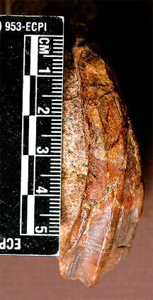 |
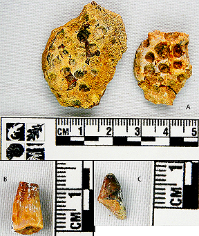
| Click on the images for larger pictures. Left--Specimens marked by letter A are crocodilian scutes; letters B and C denote well preserved crocodilian teeth--all from from the lower Cretaceous Newark Canyon Formation, Eureka County, Nevada, a number of miles from the western border of White Pine County, Nevada. Right--An iguanodont (a clade of herbivorous dinosaurs) tooth from the lower Cretaceous Newark Canyon Formation, Eureka County, Nevada, a number of miles from the western border of White Pine County, Nevada. Photographs courtesy Dr. Joshua William Bonde, Dr. Richard P. Hilton, Dr. Frankie D. Jackson, and Dr. Peter A. Druschke; I edited and processed the images through photoshop. |
 |
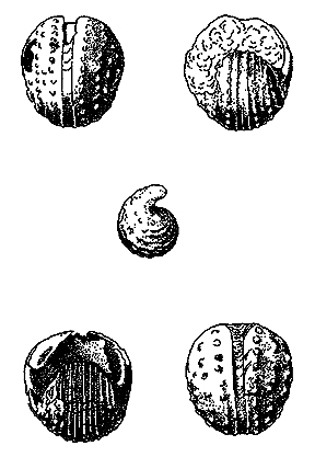 |
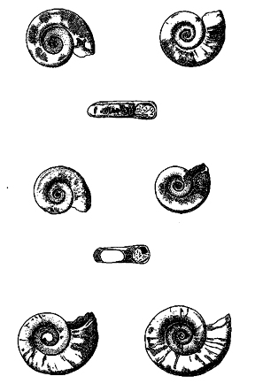
| Click on the images for larger pictures. Left--Line drawings of coiled marine gastropods from the middle Permian Arcturus Formation, White Pine County, Nevada, assigned to the genus-species Straparollus (Leptomphalus) arcturus. Photograph courtesy Thomas E Yancey; I edited and processed the image with photoshop. Right--Line drawings of bellerophon marine gastropods from the middle Permian Arcturus Formation, White Pine County, Nevada, assigned to the genus-species Euphemitopsis subpapillosa. Photograph courtesy Thomas E Yancey; I edited and processed the image with photoshop. |
 |
 |
|
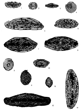
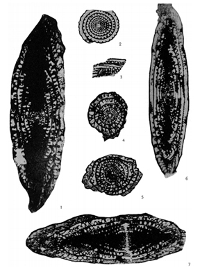
Click on the images for larger pictures. Left--Scientific cross-sections of fusulinids from the middle Permian Arcturus Formation, White Pine County, Nevada. Photograph courtesy Raymond L. Knight; I edited and processed the image with photoshop. Specimens: 1-3--Fusulinella divexa; 4-6--Triticites secalicus oryziformis; 7-10 and 13-14--Schwagerina guembeli; 11-12--Schwagerina medullaris. Right--Scientific cross-sections of fusulinids from the middle Permian Arcturus Formation, White Pine County, Nevada. Photograph courtesy Raymond L. Knight; I edited and processed the image with photoshop. Specimens: 1 and 4--Parafusulina superlata; 2,3 and 6--Parafusulina sublinearis; 5 and 7--Parafusulina splendens. |
 |
 |
|
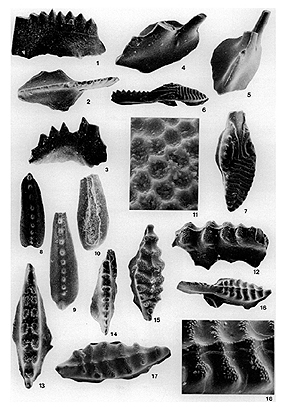
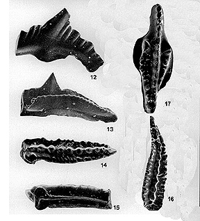
Click on the images for larger pictures. Left--Conodonts (minute tooth to jaw-like structures, unrelated to modern jaws, that served as a unique food-gathering apparatus in an extinct lamprey eel-like animal) from the lower to middle Permian Reipetown Formation (formerly called the Rib Hill Sandstone), White Pine County, Nevada. Photograph courtesy David L. Clark; I edited and processed the image through photoshop. Specimens: 1-2--Anchignanthodus minutes; 3--Anchignanthodus typicalis; 4-5 New genus; 6-7--Idiognanthodus ellisoni; 8-11--Neogondolella biselli; 12-18--Sweetognanthus whitei. Right--Conodonts (minute tooth to jaw-like structures, unrelated to modern jaws, that served as a unique food-gathering apparatus in an extinct lamprey eel-like animal) from the lower Permian Reipe Spring Limestone, White Pine County, Nevada. Photograph courtesy David L. Clark; I edited and processed the image through photoshop. Specimens: 12--Ozarkodinid element; 13--Adetognathus gigantus; 14-16--Gondolella bella; 17--Gnathodus roundyi. |
 |
 |
|
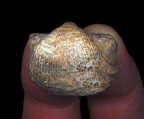
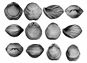
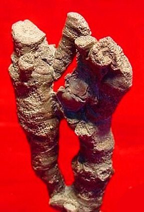
Click on the images for larger pictures. Left--A pedicle view of the brachiopod Linoproductus. The specimen happens to represent my earliest exposure to fossil brachiopods. My father collected it from the lower to middle Pennsylvanian Ely Limestone during his summer field mapping project in White Pine County, Nevada, the last of many courses he completed to successfully attain a Bachelor Of Science Degree in geology from the University of Southern California (he went on to specialize in engineering geology, with a Master of Science degree in engineering geology from the University of Southern California), and then gave it to me upon returning when I was a youngster. This particular Linoproductus came from low in the Ely section, near the contact with the underlying upper Mississippian Diamond Peak Formation, so the brach is certainly early Pennsylvanian in geologic age. It has been silicified, by the way, replaced by silicon dioxide, lending to it a nice silvery sheen. Right--A series of rather uncommon Paleozoic Era terebratuloid brachiopods from the lower to middle Pennsylvanian Ely Limestone, White Pine County, Nevada. Genus-species is Cryptacanthia savagei. Photograph courtesy Alberto Perez-Huerta; I edited and processed the image through photoshop. |
 |
 |
|
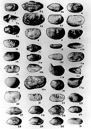
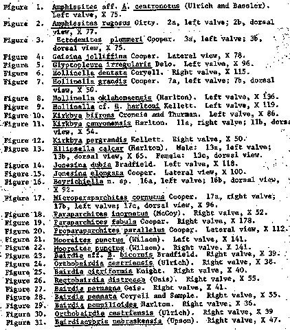
Click on the images for larger pictures. Left--A coral of the genus Crantaniophyllum from exposures of the lower to middle Pennsylvanian Ely Limetone in western Millard County, Utah, just east of the boundary with White Pine County, Nevada. Photograph by an anonymous individual on the Net; I edited and processed the image through photoshop. Right--A series of ostracods (a diminutive bi-valved crustacean) from exposures of the lower to middle Pennsylvanian Ely Limestone in western Millard County, Utah, just east of the boundary with White Pine County, Nevada. Photograph courtesy Samiha Mamoud Zazou; I edited and processed the image through photoshop. |
 |
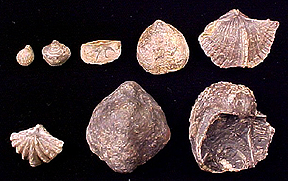 |
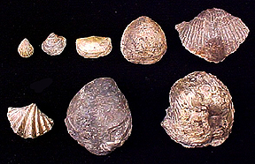
| Click on the images for larger pictures. Left and right--Both sides of the same suite of brachiopods from the lower Pennsylvanian section of the lower to the middle Pennsylvanian Ely Limestone in western Millard County, not far from the eastern border of White Pine County, Nevada. Photographs courtesy a specific web page; I edited and processed the images through photoshop. Specimens: Top row, left to right--Eumetria costata, Cliothyridina sublamellosa, Chonetes granulifer, Rhipidonella sp., Spirifer occidentalis. Bottom row, left to right--Spiriferellina sp., Composita sp., Dictyoclostus portlockianus. |
 |
 |
 |
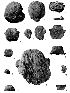 |
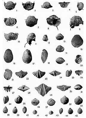
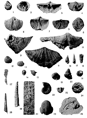
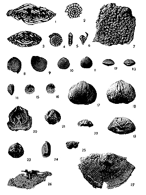
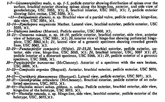
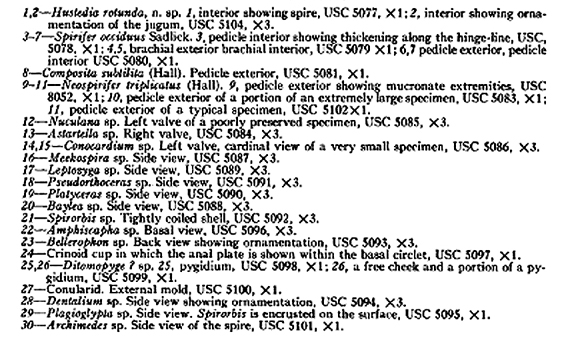
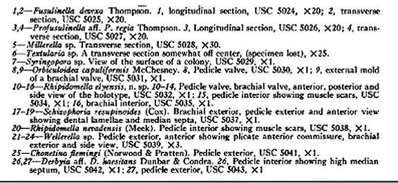
| Click on the images for larger pictures. A series of four photographs depicting various varieties of paleontologic specimens that can be found in the lower to middle Pennsylvanian Ely Limestone, White Pine County, Nevada. Photographs courtesy Bernard O. Lane; I edited and processed the images through photoshop. |

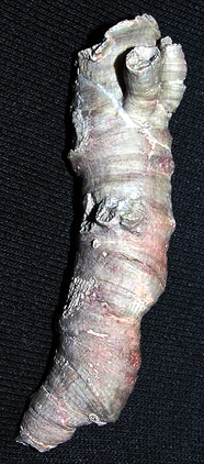 |
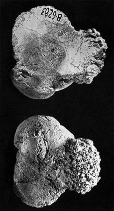 |
| Click on the images for larger pictures. Left--A coral--genus Barbouria--from the lower to middle Pennsylvanian Ely Limestone, western Millard County, Utah, not far from the eastern border of White Pine County, Nevada. Photograph courtesy Michael P. Klimetz; I edited and processed the image through photoshop. Right--Two views of a Chaetetes sponge encrusted by the coral Multithecopora hypatiea, White Pine County, Nevada. Photograph courtesy Edward C. Wilson; I edited and processed the image through photoshop. |
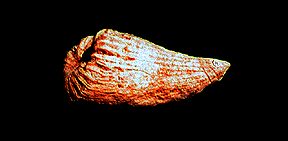 |
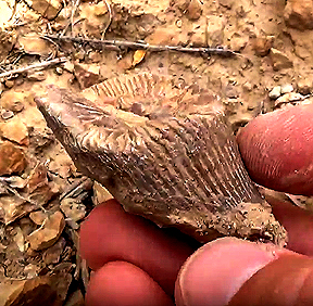 |
| Click on the images for larger pictures. Left--An extinct horn coral from the upper Mississippian Diamond Peak Formation, White Pine County, Nevada. Right--An extinct horn coral from the upper Mississippian Diamond Peak Formation, Elko County, Nevada, a number of miles north of the border with White Pine County. Photograph courtesy a person who goes by the cyber-name KOI; I edited and processed the image through photoshop. Both specimens possibly genus Caninia. |
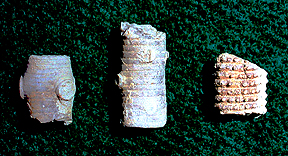 |
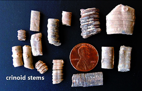 |
| Click on the images for larger pictures. Left--Specimens at left and middle are crinoid stems; fossil at right is part of a crinoid arm, which branches out from the crown, where the actual echinoderm crinoid animal lived. All from the upper Mississippian Diamond Peak Formation, eastern Eureka County, Nevada, not far from the western border with White Pine County, Nevada. Right--Crinoid stems from the upper Mississippian Diamond Peak Formation, Elko County, Nevada, a number of miles north of the border with White Pine County. Photograph courtesy a person who goes by the cyber-name KOI; I processed and edited the image through photoshop. |
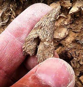 |
 |
|
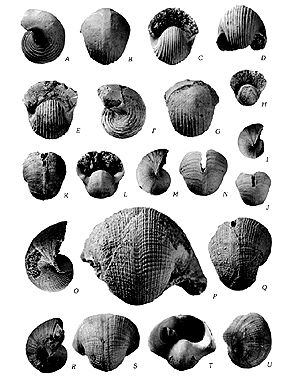
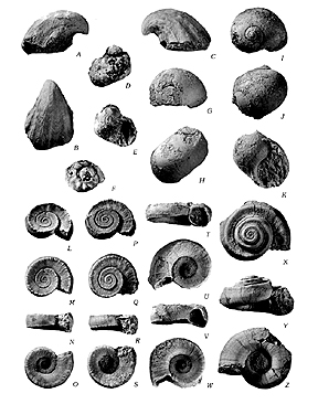
Click on the images for larger pictures. Left--An extinct horn coral, possibly genus Caninia, from the upper Mississippian Diamond Peak Formation, Elko County, Nevada, a number of miles north of the border with White Pine County, Nevada. Photograph courtesy a person who goes by the cyber-name KOI; I edited and processed the image through photoshop. Right--Bellerophon gastropods from the upper Mississippian Diamond Peak Formation, White Pine County, Nevada. Photograph courtesy Mackenzie Gordon Jr. and Ellis L. Yochelson; I edited and processed the image through photoshop. Specimens: A-G--Euphemites nevadensis; H-N--Bellerophon vespertinus; O-Q--Retispira nolani; R-U--Retispira albipinensis. |
 |
 |
|
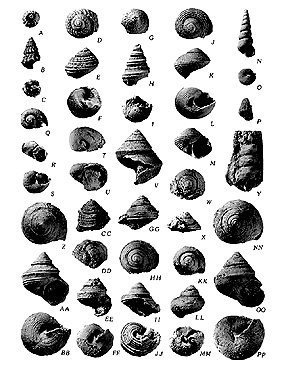
Click on the images for larger pictures. Left--Gastropods from the upper Mississippian Diamond Peak Formation, White Pine County, Nevada. Photograph courtesy Mackenzie Gordon Jr. and Ellis L. Yochelson; I edited and processed the image through photoshop. Specimens: A-C--Platyceras sp.; D-F--Turbonitella hiserialis; G, F--Naticopsis sp.; I-K--Naticopsis glomerosa; L-W--Straparollus intermedius; X-Z--Straparollus sp. Right--Gastropods from the upper Mississippian Diamond Peak Formation, White Pine County, Nevada. Photograph courtesy Mackenzie Gordon Jr. and Ellis L. Yochelson; I edited and processed the image through photoshop. Specimens: A-C--Microdoma sp.; D-F--Hammatospira bellula; G-I--Neilsonia welleri; J-M--Compsonema fragile; N, O--Donaldina sp.; P--Meekospira sp.; Q-S--Strophostylus tantallus; T, U--Strophostylus nevadensis; V-X, NN-PP--Worthenia temuleanata; Y--Achsina sp.; Z, B-B, F-F--Gabrocingulum seminumdum; CC--Gabrocingulum quadrigatum; DD--Trepospira sp.; GG-JJ--Catazona rudilirata; KK-MM--Platyzona sp. |
 |
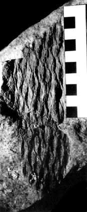 |
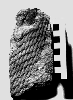
| Click on the images for larger pictures. Left and right--Two specimens of the bark of an extinct scale tree known scientifically as genus-species Lepidodendron cf. acukatum from the upper Mississippian Diamond Peak Formation, White Pine County, Nevada. Lepidodendron is most closely related to the modern quillworts--not the club mosses, as is often erroneously related. Scale is in centimeters. Photographs courtesy Chris G. Mattinson; I edited and processed the images thorugh photoshop. |
 |
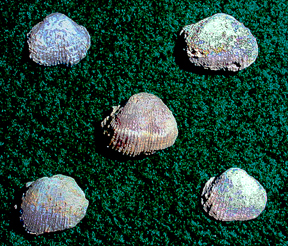 |
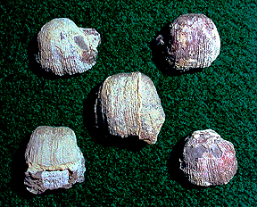
| Click on the images for larger pictures. Left--Brachiopods from the middle to upper Mississippian Chainman Shale, White Pine County, Nevada, assigned to the genus Linoproductus. Right--Brachiopods from the middle to upper Mississippian Chainman Shale, White Pine County, Nevada, assigned to the genus Antiquatonia. |
 |
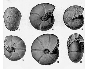 |
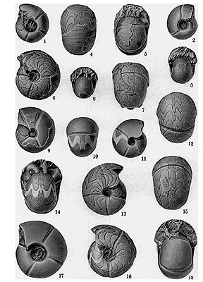
| Click on the images for larger pictures. Left and right--Ammonoids from the middle to upper Mississippian Chainman Shale, White Pine County, Nevada. Specimens--Left: 1 to 3--Cravenoceras nevadense; 4 to 16--Cravenoceras hesperium; 17, 18--Cravenoceras nevadense. Right: 4 and 5--Goniatites choclawensis; 9 to 12--Cravenoceras merriami. Photographs courtesy Walter Youngquiest; I edited and processed the images through photoshop. |
 |
 |
 |
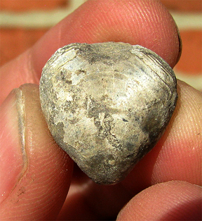 |
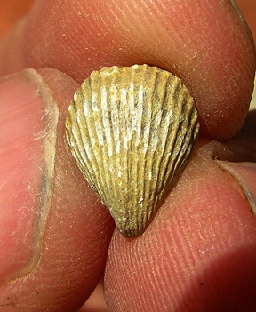
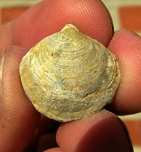
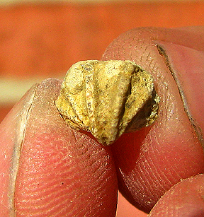
| Click on the images for larger pictures. Four brachiopods from the middle to upper Mississippian Chainman Shale, western Millard County, not far from the eastern border of White Pine County, Nevada. Top, left to right: Hustedia sp. and Cleiothyridina hirsuta. Bottom, left to right: Reticulariina sp. and Composita subtilita. Photographs courtesy Dave Hayward; I edited and processed the images through photoshop. |
 |
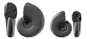 |
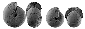
| Click on the images for larger pictures. Left and right--Ammonoids from the middle to upper Mississippian Chainman Shale, White Pine County, Nevada. Left--Goniatites sowerbyi. Right--Praedaraelites loeblichi. Photographs courtesy Dieter Korn and Allan L. Titus; I edited and processed the images through photoshop. |
 |
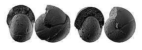 |
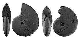
| Click on the images for larger pictures. Left and right--Ammonoids from the middle to upper Mississippian Chainman Shale, White Pine County, Nevada. Left--Girtyoceras hamiltonensis. Right--Goniatites eganensis. and right-- Photographs courtesy Dieter Korn and Allan L. Titus; I edited and processed the images through photoshop. |
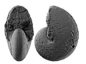 |
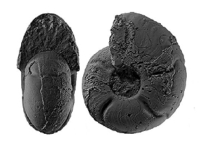 |
| Click on the images for larger pictures. Left and right--Ammonoids from the middle to upper Mississippian Chainman Shale, White Pine County, Nevada. Left--Metadimorphoceras richardsoni. Right--Girtyoceras hamiltonensis. Photographs courtesy Dieter Korn and Allan L. Titus; I edited and processed the images through photoshop. |
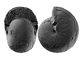 |
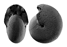 |
| Click on the images for larger pictures. Left and right--Ammonoids from the middle to upper Mississippian Chainman Shale, White Pine County, Nevada. Left and right--Goniatites deceptus. Photographs courtesy Dieter Korn and Allan L. Titus; I edited and processed the images through photoshop. |
 |
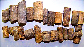 |
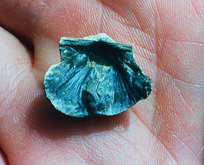
| Click on the images for larger pictures. Left--An interior view of the brachiopod Dictyoclostus sp. from the middle to upper Mississippian Chainman Shale, White Pine County, Nevada. Left--Crinoid stems from the middle to upper Mississippian Chainman Shale, White Pine County, Nevada. Photograph courtesy John P. Graham; I edited and processed the image through photoshop. |
 |
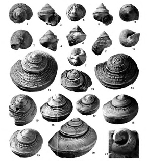 |
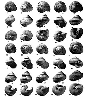
| Click on the images for larger pictures. Left and right--Gastropods from the middle to upper Mississippian Chainman Shale, western Millard County, Utah, not far from the eastern border of White Pine County, Nevada. Photographs courtesy Mackenzie Gordon Jr. and Ellis L. Yochelson; I edited and processed the images through photoshop. Specimens for image at left: 1-9--Gabrocingulum confusionense; 10-15--Glabrocingulum quadrigatum; 16-27--Glabrocingulum hosei; 28-35--Glabrocingulum binodosum. Specimens for image at right: 1-3--Gabrocingulum granulatum; 4-10--Gabrocingulum seminundum; 13-14--Gabrocingulum confusionense; 15--Gabrocingulum mephitiphontis; 16, 19--Gabrocingulum quadrigatum; 17-18--Gabrocingulum binodosum; 20--Gabrocingulum hosei; 21--Gabrocingulum sp. |
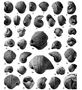 |
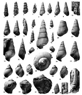 |
| Click on the images for larger pictures. Left and right--Gastropods from the middle to upper Mississippian Chainman Shale, western Millard County, Utah, not far from the eastern border of White Pine County, Nevada. Photographs courtesy Mackenzie Gordon Jr. and Ellis L. Yochelson; I edited and processed the images through photoshop. Specimens for image at left: 1-4--Euphemites sp.; 5, 6--Euphemites nevadensis; 7, 8--Retispira stenopsis; 9-11--Euphemites cracens; 12-13--Retispira jensenensis; 14, 15--Euphemites sacajawensis; 16. 17--Retispira sp.; 18-21--Retispira nolani; 22-29--Retispira ordinata; 30, 31, 36--Retispira textilis; 32-35--Retispira cincta. |
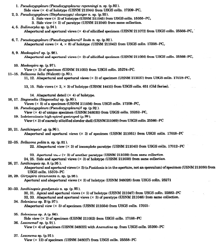
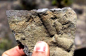 |
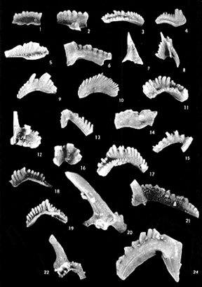 |
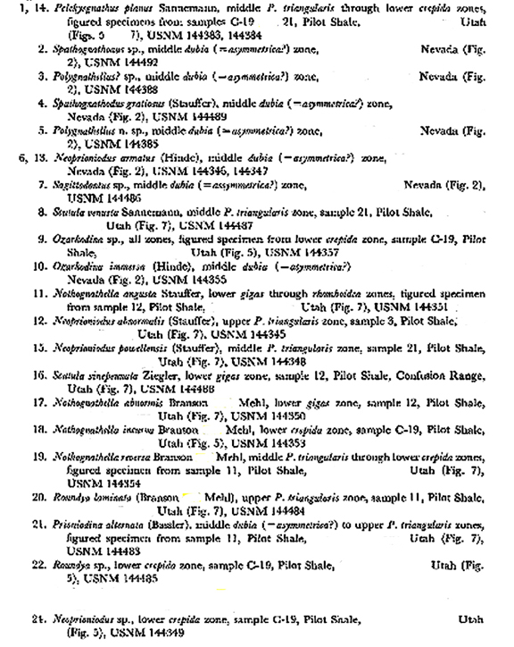
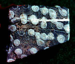
| Click on the images for larger pictures. Left--Crinoid stems from the lower Mississippian Joana Limestone, secured from exposures in Lincoln County, Nevada, a number of miles south of the border with White Pine County, Nevada. Photograph courtesy Leon Taufani; I edited and processed the image through photoshop. Right--Conodonts (minute tooth or jawlike structures, unrelated to modern jaws, that served as a unique food-gathering apparatus in an extinct lamprey eel-like animal) from the upper Devonian to lower Mississippian Pilot Shale of northern Eureka County, Nevada (a number of miles north of White Pine County, Nevada) and western Millard County, Utah (a number of miles east of the eastern border of White Pine County, Nevada). Photograph courtesy David Leigh Clark; I edited and processed the image through photoshop. |
 |
 |
| Click on the images for larger pictures. Left and right--Two views of the same chunk of limestone bearing extinct colonial corals from the middle to upper Devonian Guilmette Formation, White Pine County, Nevada. Image at left reveals the coral heads, from which the actual coral animal protruded while feeding; photograph at right is a longitudinal section, showing extent of the coral colony in vertical orientation through the limestone. The specimens are silicified, by the way, replaced by the mineral silicon dioxide. |
 |
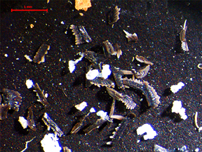 |
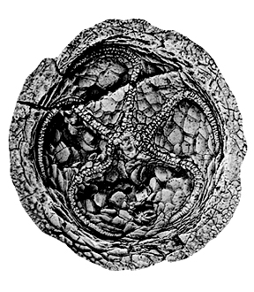
| Click on the images for larger pictures. Left--An edrioasteroid echinodern--called scientifically Postibulla lukei--from the middle to upper Devonian Guilmette Formation, Elko County, Nevada, a number of miles north of White Pine County, Nevada. Photograph courtesy Bruce M. Bell and Morris S Petersen; I edited and processed the image through photoshop. Right--Unspecified conodonts (minute jaw or tooth-like structures, unrelated to modern jaws, that served as a unique food-gathering apparatus in an extinct lamprey eel-like animal) from the middle to upper Devonian Guilmette Formation, Lincoln County, Nevada, a number of miles south of White Pine County, Nevada. Red scale bar at upper left is one millimeter long (3/64 of an inch). Photograph courtesy Andrew Retzler; I edited and processed the image through photoshop. |
 |
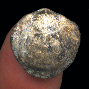 |
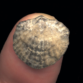
| Click on the images for larger pictures. Left and right--Brachiopods from the middle to upper Devonian Guilmette Formation, White Pine County, Nevada; their original shells have been silicified, replaced by the mineral silicon dioxide. Both can be assigned to the genus Spinatrypa. |
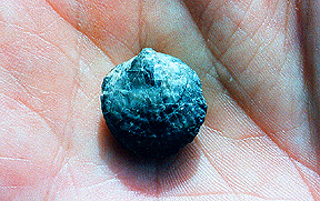 |
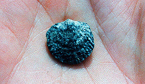 |
| Click on the images for larger pictures. Left and right--Brachiopods from the middle to upper Devonian Guilmette Formation, White Pine County, Nevada; their original shells have been silicified, replaced by the mineral silicon dioxide. Specimen at left is assigned to Leptathyris circula; brach at right is genus Spinatrypa. |
 |
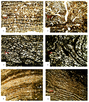 |
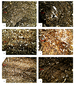
| Click on the images for larger pictures. Left and right--Scientific cross-sections of stromatoporoids--an extinct variety of calcareous sponge--from the middle to upper Devonian Guilmette Formation, Lincoln County, Nevada, a number of miles south of White Pine County, Nevada. Stromatoporoid sponges are among the more common fossil types found in the Guilmette Formation. Photographs courtesy Jeffrey Lee Aul; I edited and processed the images through photoshop. Stromatoporoid specimens from middle to upper Devonian Guilmette Formation figured at left: 1-2--Trupetostromo bassleri; 3-4--Hermatoporella sp.; 5-6--Arctostroma contextum. Stromatoporoid specimens from middle to upper Devonian Guilmette Formation figured at right: 1-2--Atelodictyon sp.; 3-4--Hammatostroma albertense; 5-6--Actinostroma cf. A. clathratum. |
 |
 |
|
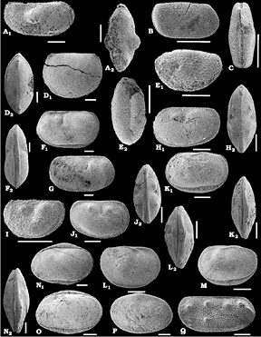
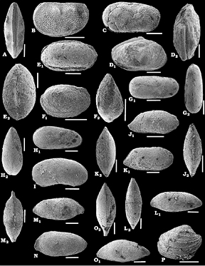
Click on the images for larger pictures. Left and right--Ostracods (a minute bi-balved crustacean) from the middle to upper Devonian Devils Gate Limestone, Eureka County, a number of miles west of the western border of White Pine County, Nevada. The specimens are of middle Devonian geologic age. Photographs courtesy Jean-Georges Casier, Ivan Berra, Ewa Olempska, Charles Sandberg, and Alain Preat; I edited and processed the images through photoshop. Specimens for image at left: A. Amphissites sp. A. Car. carapace in right lateral (A1) and dorsal (A2) views. B, C. Youngiella cf. mica Rozhdestvenskaja, 1972. B. Carapace in right lateral view. C. Carapace in dorsal view. D. Rozhdestvenskayites sp. A. Carapace in left lateral (D1) and dorsal (D2) views. E. Coelonella sp. A. Carapace in left lateral (E1) and dorsal (E2) views. F, G. Knoxiella? rauseri (Tschigova, 1977). F. Carapace in left lateral (F1) and dorsal (F2) views. G. Carapace in right lateral view. Knoxiella? sp.Aaff. K. rauseri (Tschigova, 1977). Carapace in left lateral (H1) and dorsal (H2)views. I. Knoxiella sp. B aff. K. ornata Lethiers, 1981. Carapace in left lateral view. J. Knoxiella sp. C aff. K. ornata Lethiers, 1981. Carapace in right lateral (J1) and dorsal (J2) views. K, L, M. Serenida dorsoplicata sp. nov. K. Holotype, carapace in left lateral (K1) and dorsal (K2) views. L. Carapace in right lateral (L1) and dorsal (L2) views. M. Carapace in left lateral view. N,O, P. Voronina? eureka sp. nov. N. Holotype, carapace in left lateral (N1) and dorsal (N2) views. O. Carapace in left lateral view. P. Carapace in right lateral view. Q. Westmontia devilensis Casier and Lethiers, 1997. Right valve in lateral view. Scale bars 200 um (roughly one one-hundreth of an inch). Specimens for image at right: A, B. Westmontia devilensis Casier and Lethiers, 1997. A. Carapace in dorsal view. B. Carapace in left lateral view. C. Platycopina indet. Carapace in left lateral view. D. Plagionephrodes cf. medius (Loranger, 1963). Carapace in right lateral (D1) and dorsal (D2) views. E. Microcheilinella sp. A. Carapace in right lateral (E1) and dorsal (E2) views. F. Pachydomellidae? indet. Carapace in right lateral (F1) and dorsal (F2) views. G. Elliptocyprites lorangeri Lethiers, 1981. Carapace in right lateral (G1) and dorsal (G2) views. H. Cytherellina sp. A Carapace in right lateral (H1) and dorsal (H2) views. I. Bairdiacypris cf. martinae Casier and Lethiers, 1997. Carapace in right lateral view. J. Bairdia sp. A. Carapace in right lateral (J1) and dorsal (J2) views. K. Bairdia sp. B. Carapace in right lateral (K1) and dorsal (K2) views. L. Acratia sp. A aff. sp. 42 sensu Braun (1967). Carapace in right lateral (L1) and dorsal (L2) views. M, N. Acratia sp. B aff. sp. 271 sensu Braun (1967). M. Carapace in right lateral (M1) and dorsal (M2) views. N. Carapace in left lateral view. O. Acratia sp. C aff. 274 sensu Braun (1967). Carapace in right lateral (O1) and dorsal (O2) views. P. Cryptophyllus sp. A aff. sp. 11 sensu Braun (1967). Right valve in lateral view. Scale bars 200 um (roughly one one-hundredth of an inch). |
| Note--The Nevada Formation of long-held, time-honored usage represented five regionally mappable subunits, or members, which in ascending order or geologic age consisted of: Beacon Peak Dolomite; Oxyoke Canyon Sandstone; Sentinel Mountain Dolomite; Woodpecker Limestone; and Bay State Dolomite. Current stratigraphic convention abandons the term Nevada Formation altogether in favor of elevating to full formational rank all five individual members. Herein, though, I summarily reject that stratigraphic reorganization and continue to use the older, more appropriate designation--Nevada Formation, retaining as distinct subunits the five recognizeable members. |
 |
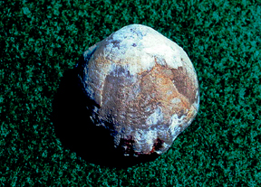 |
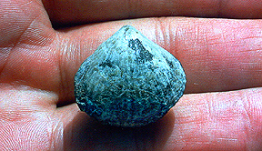
| Click on the images for larger pictures. Left and right--Two brachiopods from the lower to middle Devonian Nevada Formation, White Pine County, Nevada. Specimen at left is assigned to the genus Athyrhynchus; brach at right is called scientifically Schizophoria. |
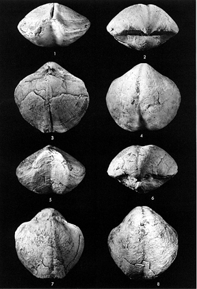 |
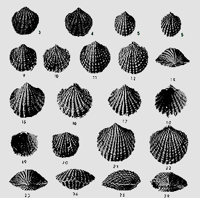 |
| Click on the images for larger pictures. Left--Brachiopods from the lower to middle Devonian Nevada Formation, Eureka County, Nevada, a number of miles west of the western border of White Pine County, Nevada. Called scientifically, Warrenella franklinii; middle Devonian in geologic age. Photograph courtesy J. G. Johnson; I edited and processed the image through photoshop. Right--Brachiopods from the lower to middle Devonian Nevada Formation, Eureka County, Nevada, a number of miles west of the western border of White Pine County, Nevada. Specimens: 3-6--Spinatrypa (Invertrypa) subnuba; 9-12 and 14-29--Anatrypa calypso. Middle Devonian in geologic age. Photograph courtesy J. G. Johnson; I edited and processed the image through photoshop. |
 |
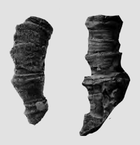 |
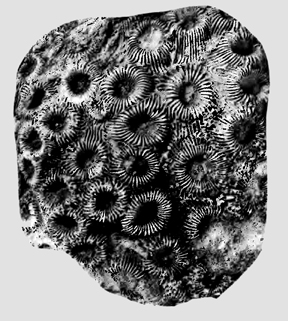
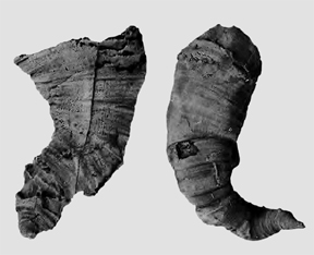
| Click on the images for larger pictures. Left and right--Corals from the lower to middle Devonian Nevada Formation, Eureka County, Nevada, a number of miles west of the western border of White Pine County. Specimen at left is called scientificallyTaimyrophyllum nolani, of middle Devonian geologic age; specimen at right (two different views of same coral) is called genus-species Siphonophrentis (Breviphrentis) kobehensis, of early Devonian geologic age. Photographs courtesy Charles W. Merriam; I edited and processed the images through photoshop. |
 |
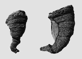 |
| Click on the images for larger pictures. Left and right--Corals from the lower to middle Devonian Nevada Formation, Eureka County, Nevada, a number of miles west of the western border of White Pine County. Specimen at left (two views of same coral) is called scientifically Kobeha cf. K. walcotti, of early Devonian geologic age; specimen at right (two different views of same coral) is called genus-species Cystiphylloides lonense, of early Devonian geologic age. Photographs courtesy Charles W. Merriam; I edited and processed the images through photoshop. |
 |
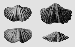 |
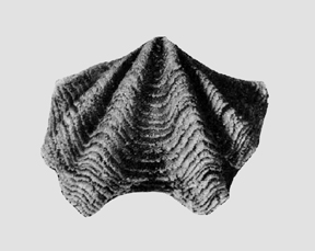
| Click on the images for larger pictures. Left and right--Brachiopods from the lower Devonian Rabbit Hill Limestone, Eureka County, Nevada, a number of miles west of the western border of White Pine County, Nevada. Specimen at left is genus-species Kozlowskiellina nolani. Brachs at right have been assigned to Howellella cycloptera. Photographs courtesy Charles W. Merriam; I edited and processed the images through photoshop. |
 |
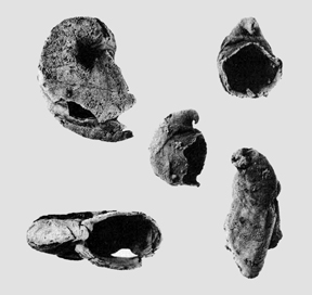 |
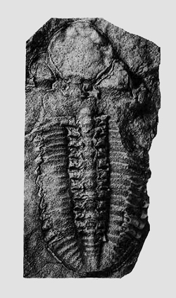
| Click on the images for larger pictures. Left--A trilobite from the lower Devonian Rabbit Hill Limestone, Eureka County, Nevada, a number of miles west of the western border of White Pine County, Nevada. Called scientifically Phacops canadensis. Right--Gastropods from the lower Devonian Rabbit Hill Limestone, Eureka County, Nevada, a number of miles from the western border of White Pine County, Nevada. All belong to genus Platyceras. Photographs courtesy Charles W. Merriam; I edited and processed the images through photoshop. |
 |
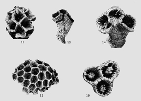 |
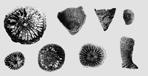
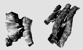
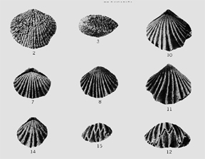
| Click on the images for larger pictures. Left--Corals from the lower Devonian Rabbit Hill Limestone, Eureka County, Nevada, a number of miles west of the western border of White Pine County, Nevada. All specimens referred to Syringaxon foerste. Right--Corals from the lower Devonian Rabbit Hill Limestone, Eureka County, Nevada, a number of miles from the western border of White Pine County, Nevada. Specimens: 11 and 12 are Pleurodictyum nevadensis--the rest belong to Pleurodictyum dunbari. Photographs courtesy Charles W. Merriam; I edited and processed the images through photoshop. |
 |
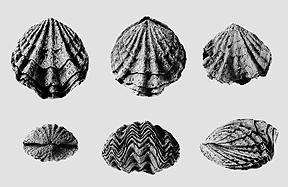 |
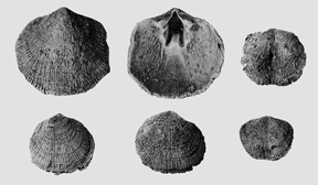
| Click on the images for larger pictures. Left--Brachiopods from the lower Devonian Rabbit Hill Limestone, Eureka County, Nevada, a number of miles west of the western border of White Pine County, Nevada. Specimens--Top row, all Levenea subcarinata subsp. antelopensis n. subsp; bottom row, left to right--first two specimens are Rhipidomella rossi; brach at far right is Levenea subcarinata subsp. antelopensis n. subsp. Right--Brachiopods from the lower Devonian Rabbit Hill Limestone, Eureka County, Nevada, a number of miles from the western border of White Pine County, Nevada. All specimens identified as Leptocoelia occidentalis. Photographs courtesy Charles W. Merriam; I edited and processed the images through photoshop. |
 |
 |
| Click on the images for larger pictures. Left--Corals from the upper Silurian Lone Mountain Dolomite, Eureka County, Nevada, a number of miles west of the western border of White Pine County, Nevada. Called scientifically Entelophyllum engelmanni. Photograph courtesy Charles W. Merriam; I edited and processed the image through photoshop. Right--Brachiopods from the upper Silurian Lone Mountain Dolomite, Eureka County, Nevada, a number of miles west of the western border of White Pine County, Nevada. Specimens: 2, 3--Atrypa sp.; 5, 6--Camarotoechia sp.; 7-9--Camarotoechia pahranagatensis; 10-15--Camarotoechia sp. Photograph courtesy Charles W. Meriam; I edited and processed the image through photoshop. |
 |
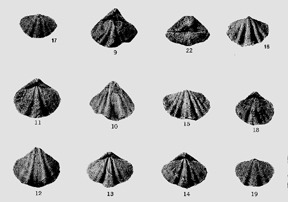 |
| Click on the images for larger pictures. Left--Brachiopods from the upper Silurian Lone Mountain Dolomite, Eureka County, Nevada, a number of miles west of the western border of White Pine County, Nevada. Specimens: 3-5--Howellella smithi; 27--Hyattidina; 34, 35--Hindella sp. Photograph courtesy Charles W. Merriam; I edited and processed the image through photoshop. Right--Brachiopods from the upper Silurian Lone Mountain Dolomite, Eureka County, Nevada, a number of miles west of the western border of White Pine County, Nevada. Secimens: 7-19--Howellella smithi; 22--Howellella pauciplicata. Photograph courtesy Charles W. Merriam; I edited and processed the image through photoshop. |
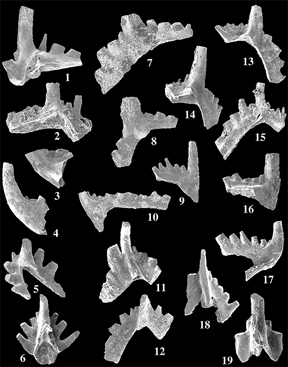 |
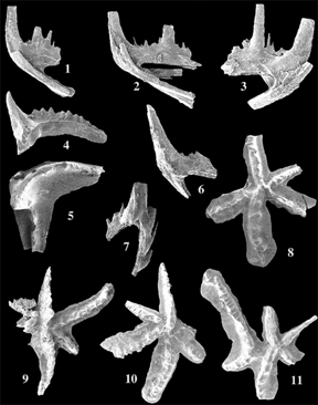 |
| Click on the images for larger pictures. Left--Conodonts (minute tooth to jaw-like structures, unrelated to modern jaws, that served as a unique food-gathering apparatus in an extinct lamprey eel-like animal) from an upper Ordovician section of the upper Ordovician to lower Silurian Hanson Creek Formation, Eureka County, Nevada, a number of miles west of the western border of White Pine County, Nevada. Specimens: 1-6--Oulodus ulrichi; 7-12--Plectodina tenuis; 13-16, 18-19--Oulodus rohneri; 17--undetermined conodont element (new species, perhaps). Photograph courtesy Walter C. Sweet; I edited and processed the image through photoshop. Right--Conodonts from an upper Ordovician section of the upper Ordovician to lower Silurian Hanson Creek Formation, Eureka County, Nevada, a number of miles west of the western border of White Pine County, Nevada. All specimens referred to genus-species Amorphognathus ordovicucus. Photographs courtesy Michael C. Sweet; I edited and processed the images through photoshop. |
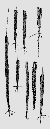 |
 |
| Click on the images for larger pictures. Left--Graptolites from an upper Ordovician section of the upper Ordovician to lower Silurian Hanson Creek Formation, Eureka County, Nevada, a number of miles west of the western border of White Pine County, Nevada; they are latex casts of the original specimens, thus revealing actual three-dimensional morphology of the extinct colonial animal. Specimens: 4, 6, 7, 11, and 16--Climacograptus hastatus; 17--Glyptograptus n. sp.; 19--Orthograptus truncatus cf. 0. t. var. pauperatus; 21--Climacograptus tridentatus. Right--Graptolites from an upper Ordovician section of the upper Ordovician to lower Silurian Hanson Creek Formation, Eureka County, Nevada, a number of miles west of the western border of White Pine County, Nevada. Both graptolites referred to the genus-species Dicellograptus complanatus; they reside on their original shale bedding planes. Photographs courtesy Rueben J. Ross and William B. N. Berry; I edited and processed the images through photoshop. |
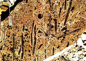 |
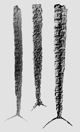 |
| Click on the images for larger pictures. Left--Graptolites from an upper Ordovician section of the middle to upper Ordovician Vinini Formation in Eureka County, a number of miles west of the western borner with White Pine County, Nevada. Called scientifically Metabolograptus extraordinarius. Photograph courtesy Charles E. Mitchell; I edited and processed the image through photoshop. Right--Latex casts of graptolites (revealing original three-dimensional morphology of the extinct colonial animal) from a late middle Ordovician section of the middle to upper Ordovician Vinini Formation. Genus-species is Climacograptus bicornis. Photograph courtesy Rueben J. Ross and William B. N. Berry; I edited and processed the image through photoshop. |
 |
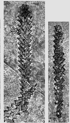 |
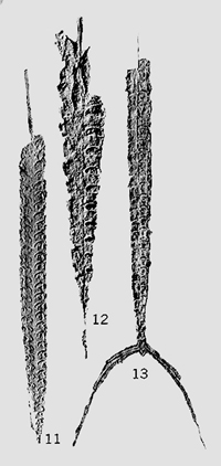
| Click on the images for larger pictures. Left--Latex casts of graptolites (revealing original three-dimensional morphology of the extinct colonial animal) from a late middle Ordovician section of the middle to upper Ordovician Vinini Formation in Eureka County, a number of miles west of the western borner with White Pine County, Nevada. Called scientifically Climacograptus caudatus (11 and 12) and Climacograptus bicornis (13). Photograph courtesy Rueben J. Ross and William B. N. Berry; I edited and processed the image through photoshop. Right--Graptolites from an upper Ordovician section of the middle to upper Ordovician Vinini Formation. Genus-species is Rectograptus abbreviatus. Photograph courtesy Petr Storch, Charles E. Mitchell, Stanley C. Finney, and Michael J. Melchin; I edited and processed the image through photoshop. |
 |
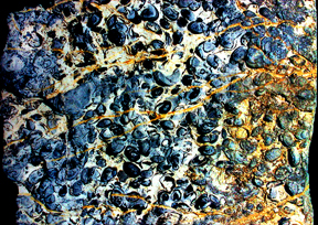 |
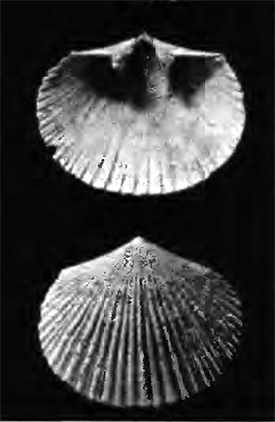
| Click on the images for larger pictures. Left--Exterior and interior views of a brachiopod pedicle valve from the late middle Ordovician Antelope Valley Limestone, Eureka County, Nevada, a number of miles west of the western border of White Pine County, Nevada. Genus-species is Desmorthis nevadensis. Photograph courtesy Rueven James Ross, Jr.; I edited and processed the image through photoshop. Right--The black pea to bean-shaped specimens embedded in the limestone are genus Leperditia ostracods, an unusually large variety of the invariably diminutive (often no wider than a millimeter--3/64 of an inch) bivalve crustaceans, from the late middle Ordovician Lehman Formation (youngest member of the Pogonip Group), White Pine County, Nevada. |
 |
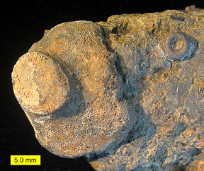 |
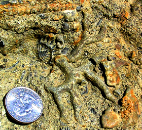
| Click on the images for larger pictures. Left--A branching bryozoan colony, just to the right of the US quarter, embedded in a bioclastic bed in the late middle Ordovician Kanosh Shale of western Millard County, Utah, a number of miles east of the eastern border of White Pine County, Nevada. Also embedded in the fossil-rich matrix are abundant minute rhipidocystid echinoderm plates, in addition to at least two fragmental trilobite specimens. Photograph courtesy an individual who goes by the cyber-name Ammonoid; I edited and processed the image through photoshop. Right--At center to left side of image is a bryozoan colony embedded on a hardground in the late middle Ordovician Kanosh Shale, western Millard County, Utah, a number of miles east of the eastern border of White Pine County, Nevada; rounded bead-like object at upper right is an eocrinoid holdfast, a specialized morphological feature that served to anchor the echinoderm to the substrate during life. Genus-species is Orbipora utahensis, a member of the bryozoan Order called Esthonioporata. Photograph courtesy Dr. Mark A. Wilson; I edited and processed the image through photoshop. |
 |
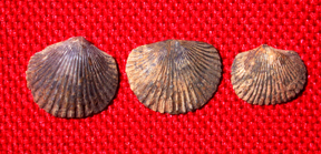 |
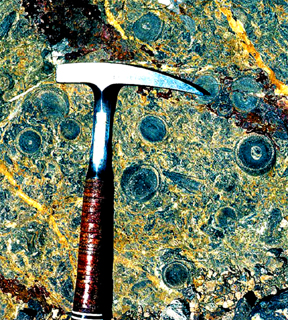
| Click on the images for larger pictures. Left--The dark circular objects embedded along the calcareous bedding plane belong to an extinct green algae called Receptaculites; from the late middle Ordovician Kanosh Shale, White Pine County, Nevada. Photograph courtesy Ronald R. McDowell; I edited and processed the image through photoshop. Right--brachiopods from the late middle Ordovician Kanosh Shale, western Millard County, Utah, a number of miles east of the eastern border of White Pine County, Nevada. Genus-species is assigned to Shoshonorthis michaelis. |
 |
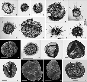 |
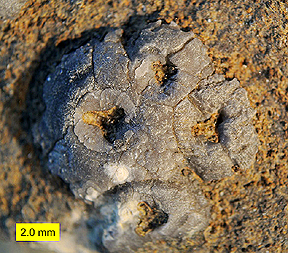
| Click on the images for larger pictures. Left--Four rhipidocystid eocrinoid holdfasts fused together in the late middle Ordovician Kanosh Shale, Pogonip Group, western Millard County, Utah, a number of miles east of the eastern border of White Pine County, Nevada. The holdfasts served to anchor the extinct echinoderm to the sea floor during life; resembles in many key morphological respects the extinct echinoderm genus Mandalacystis. Photograph courtesy Dr. Mark A. Wilson; I edited and processed the image through photoshop. Right--Acritarchs (microscopic, presumably eukaryotic cells that probably represent resting cysts of green algae) from the late middle Ordovician Kanosh Shale, western Millard County, Utah, a number of miles east of the eastern border of White Pine County, Nevada. Specimens: Top row, left to right: (1) Asteridium sp. ; (2) Digitoglomus minutum; (3) D. minutum; (4) Gorgonisphaeridium sp; (5) Micrhystridium stellatum. Second row--left to right: (6) Passalosphaera minuta; (7) Petaloferidium sp.; (8) Turpisphaera heteromorpha; (9) Turpisphaera heteromorpha. Third row--left to right: (10) Dictyotidium vietulum; (11) D. vietulum; (12) Melikeriopalla sp.; (13) Dicommopalla macadamii. Bottom row--left to right: (14) Dicommopalla; (15) Dicommopalla sp.; (16) Loeblichia heterorhabda; (17) L. heterorhabda. Scale bar is 10 microns long--0.00039 of an inch. Photograph courtesy Marco Vecoli, John H. Beck, and Paul K. Strother; I edited and processed the image through photoshop. |
 |
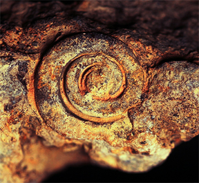 |
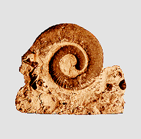
| Click on the images for larger pictures. Left and right--Gastropods from the late middle Ordovician Kanosh Shale, western Millard County, Utah, a number of miles from the eastern border of White Pine County, Nevada. Gastropod at left is called scientifically, Barnesella measuresae. Photograph courtesy Robyn Mieko Dahl. Gastropod at right is assigned to genus-species Malayaspira hintzei. Photograph courtesy davehunt; I edited and processed the images through photoshop. |
 |
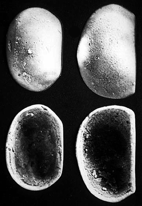 |
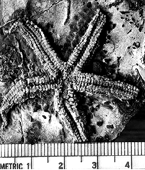
| Click on the images for larger pictures. Left--A starfish from the late middle Ordovician Kanosh Shale, western Millard County, Utah, a number of miles east of the eastern border of White Pine County, Nevada. Scale is in millimeters and centimeters. Right--Exterior and interior views of genus-species Leperditella valida ostracods (a bivalve crustacean) from the late middle Ordovician Kanosh Shale, western Millard County, Utah, a number of miles east of the eastern border of White Pine County, Nevada. Photographs courtesy Lehi F. Hintze and Fitzhugh D. Davis; I edited and processed the images through photoshop. |
 |
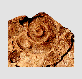 |
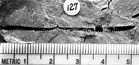
| Click on the images for larger pictures. Left--A graptolite from the middle Ordovician Juab Limestone, western Millard County, Utah, a number of miles east of the eastern border of White Pine County, Nevada. Genus-species is assigned to Didymograptus nitidus. Photograph courtesy Lee F. Braithwaite; I edited and processed the image through photoshop. Right--A gastropod from the middle Ordovician Juab Limestone, western Millard County, Utah, a number of miles east of the eastern border of White Pine County, Nevada. Called scientifically, Monitorella auricula. Photograph courtesy Robyn Mieko Dahl; I edited and processed the images through photoshop. |
 |
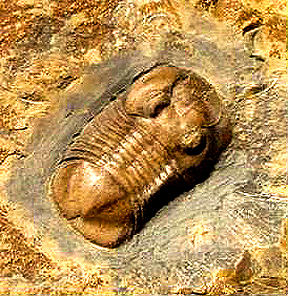 |
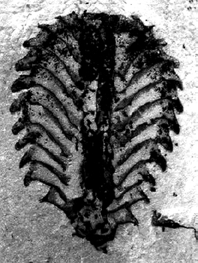
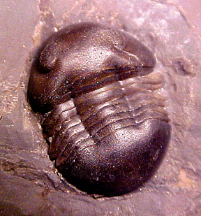
| Click on the images for larger pictures. Left--A graptolite from the lower Ordovician Wah Wah Limestone, western Millard County, Utah, a number of miles east of the eastern border of White Pine County, Nevada. Genus-species is assigned to Phyllograptus anna. Photograph courtesy Lee F. Braithwaite; I edited and processed the image through photoshop. Right--A trilobite from the lower Ordovician Fillmore Formation, western Millard County, Utah, a number of miles east of the eastern border of White Pine County, Nevada. Called scientifically, Ptyocephalus yersini. Photograph courtesy Brent Lewis; I edited and processed the image through photoshop. |
 |
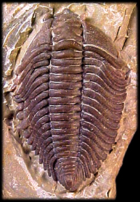 |
| Click on the images for larger pictures. Left and right--Trilobites from the lower Ordovician Fillmore Formation, western Millard County, Utah, a number of miles east of the eastern border of White Pine County, Nevada. Specimen at left is called scientifically, Presbynelius ibexensis. Photograph courtesy an anonymous individual; I edited and processed the image through photoshop. Trilobite at right is genus-species Pseudocybele altinasuta. Photograph courtesy Andrew Milner; I edited and processed the image through photoshop. |
 |
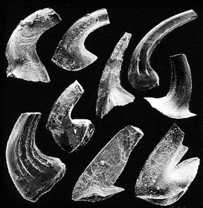 |
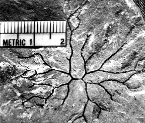
| Click on the images for larger pictures. Left--A dendroid graptolite from the lower Ordovician Fillmore Formation, western Millard County, Utah, a number of miles east of the eastern border of White Pine County, Nevada. Called scientifically, Clonograptus flexilis. Photograph courtesy Lee F. Braithwaite; I edited and processed the image through photoshop. Right--Conodonts (minute tooth or jaw-like structures, unrelated to modern jaws, that served as a unique feeding apparatus in an extinct lamprey eel-like animal) from the lower Ordovician Fillmore Formation, western Millard County, Utah, a number of miles east of the eastern border of White Pine County, Nevada. Specimens--clockwise starting at upper left: 1--Drepanodus arcuatus; 2--Drepanoistodus basiovalis; 3--Acodus deltatus; 4--Scolopodus rex; 5--Drepanoistodus basiovalis; 6--Drepanoistodus basiovalis; 7--Paltodus jemtlandicus; 8--Oneotodus costatus; 9--Drepanodus arcuatus. Photograph courtesy Lehi F. Hintze and Fitzhugh D. Davis; I edited and processed the image through photoshop. |
 |
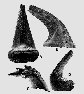 |
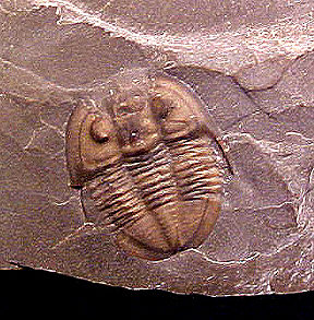
| Click on the images for larger pictures. Left--A trilobite from the lower Ordovician Fillmore Formation, western Millard County, Utah, a numbe of miles east of the eastern border of White Pine County, Nevada. Specimen at left is called scientifically, Isoteloides flexus. Photographed courtesy an anonymous individual; I edited and processed the image through photoshop. Specimens at right--Conodonts (minute tooth or jaw-like structures, unrelated to modern jaws, that served as a unique feeding apparatus in an extinct lamprey eel-like animal) from the lower Ordovician House Limetone, western Millard County, Utah, a number of miles east of the eastern border of White Pine County, Nevada. Specimens: A--Aloxoconus iowensi; B--Paltodus sp.; C--Hirsutodontus simpex; D--Iapetognathus sp. Photograph courtesy M. M. Craig; I edited and processed the image through photoshop. |
 |
 |
|
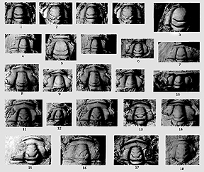
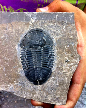
Click on the images for larger pictures. Left--Trilobite cephalons (the head shield) from the upper Cambrian Dunderberg Shale, Eureka County, Nevada, a number of miles west of the western border of White Pine County, Nevada. Specimens: Top row, lef to right: 1--Irvingella eurekensis; 2, 3--Irvingella angustilimbatus. Second row, left to right: 4--Elvinia granulata; 5--Elvinia hamburgensis; 6-- Elvinia sp.; 7--Elvinia roemeri. Third row, left to right: 8--Elviniella sp.; 9, 10--Elviniella laevis. Fourth row, left to right: 11-13--Elburgia quinnensis; 14--Elviniella sp. Fifth row, left to right: 15--Elburgia quinnensis; 16, 17--Elburgia granulosa; 18--Olenusf wilsoni. Photograph courtesy Allison R. Palmer; I edited and processed the image through photoshop. Right--A trilobite from the middle Cambrian Wheeler Shale, western Millard County, Utah, a number of miles east of the eastern border of White Pine County, Nevada. Specimen at left is called scientifically, Asaphiscus wheeleri. Photographed courtesy an anonymous individual from U-Dig Fossils. I edited and processed the image through photoshop. |
 |
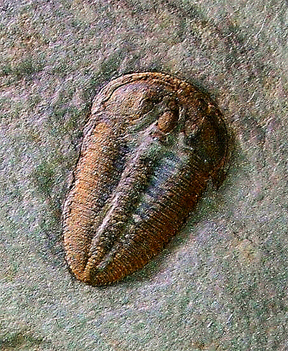 |
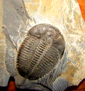
| Click on the images for larger pictures. Left and right--Trilobites from the middle Cambrian Wheeler Shale, western Millard County, Utah, a number of miles east of the eastern border of White Pine County, Nevada. Specimen at left is called scientifically, Elrathia kingi. Photographed courtesy a person called Bob. Trilobite at right is assigned to the genus-species Altiocculus harrisi. Photograph courtesy an individual who goes by the cyber-name ynot. I edited and processed the image through photoshop. |
 |
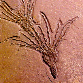 |
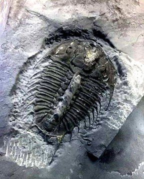
| Click on the images for larger pictures. Left--A trilobite from the middle Cambrian Wheeler Shale, western Millard County, Utah, a number of miles east of the eastern border of White Pine County, Nevada. Called scientifically, Olenoides nevadensis. Photographed courtesy an anonymous individual. At right are two early echinoderms preserved along the same bedding plane from the middle Cambrian Wheeler Shale, western Millard County, Utah, a number of miles east of the eastern border of White Pine County, Nevada. Both have been assigned to the genus-species Gogia spiralis. Photograph courtesy an anonymous individual. I edited and processed the image through photoshop. |
|